

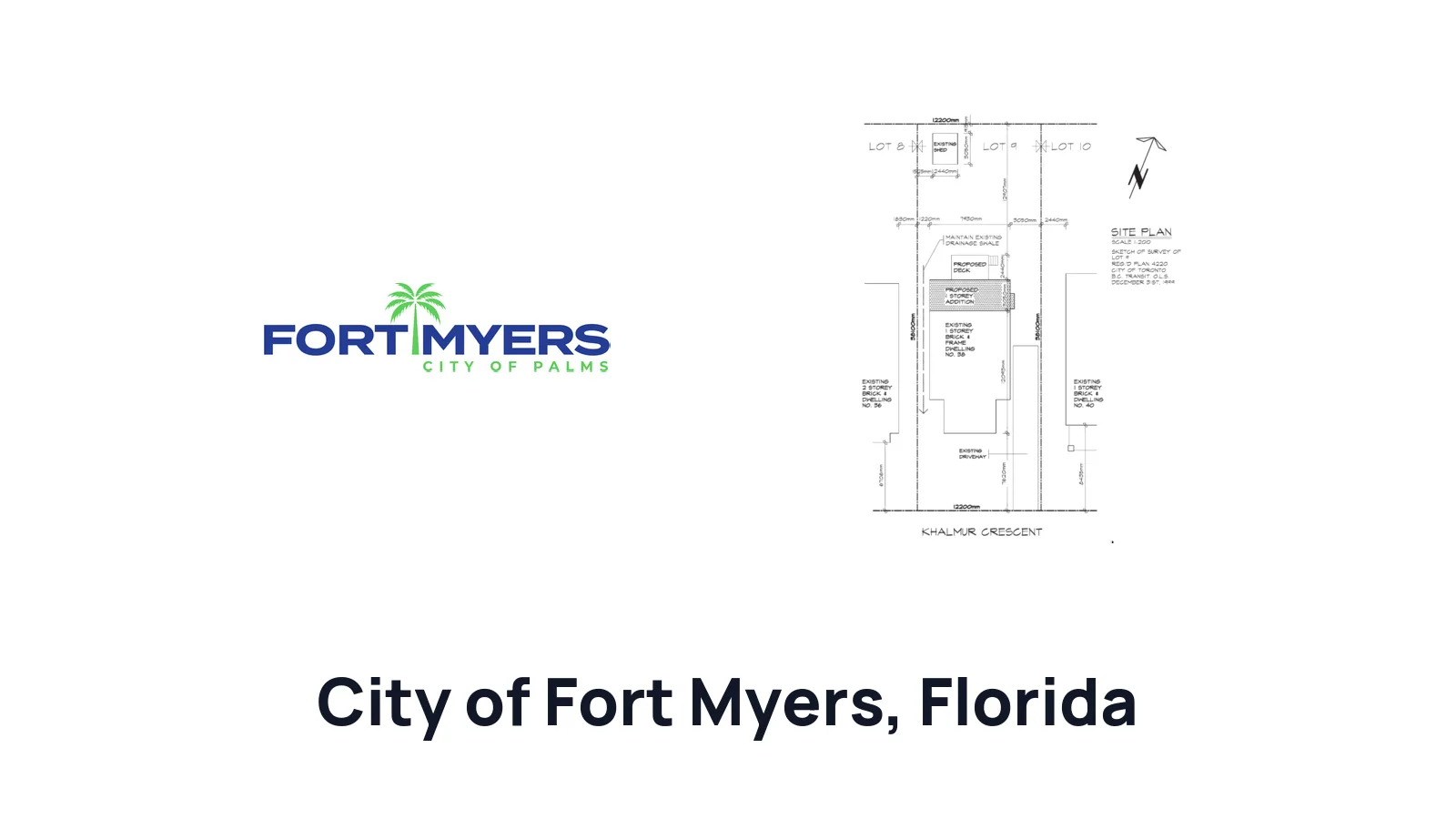
How to Draw a Site Plan for a Residential Building Permit in City of Fort Myers

Ilya Tkachov
Updated
If you are applying for a residential building permit in City of Fort Myers, the site plan is the drawing that shows where the work will happen on your property. For simple fence or shed projects, City of Fort Myers may accept an aerial photo or drawing when it clearly shows the required details. For site-built pools, spas, and fountains, the city asks for a boundary survey showing current conditions plus a site plan with the pool location, property-line distances, and drainage flow arrows.
This guide explains how to draw a site plan for a residential building permit in City of Fort Myers, what details to include for common homeowner projects, and when to use an aerial image, hand drawing, or boundary survey as your starting point.
What is a site plan?
Site plan definition
A site plan is a top-down drawing of your property. It shows the lot, existing buildings, driveways, streets, easements, proposed work, and the measurements that connect those items.
For a homeowner, the easiest way to think about it is this: a site plan for property shows what is already on the lot and what you want to add or change. A site plan for a residential building permit helps City of Fort Myers review the proposed pool, fence, shed, utility structure, driveway paving, or other exterior work in relation to property lines, easements, streets, driveways, drainage, and nearby structures.
The drawing does not need to look like a professional architectural sheet for every small project. It needs to be readable, dimensioned, and specific enough that the reviewer can confirm where the work is located.
Common site plan terminology
| Term | Plain-English meaning | Example |
|---|---|---|
| Setbacks | The distances from a structure or proposed structure to the property lines, roads, rights-of-way, easements, or water bodies when those items apply. |  Setback example Setback example |
| Existing buildings and structures | Things already on the property, such as the house, driveway, fence, pool, shed, garage, patio, or other structures near the work area. |  Existing structures example Existing structures example |
| Proposed buildings and structures | New items you want approval for, such as a proposed pool, fence, gate, shed, utility structure, driveway paving, or parking-area change. |  Proposed structures example Proposed structures example |
| Dimensions | Measurements written directly on the drawing, including the size of the proposed work, fence lengths and heights, driveway or parking dimensions, and distances to property lines. |  Site plan dimensions example Site plan dimensions example |
| Lot lines or property lines | The legal edges of your property. These are the lines reviewers use when checking setbacks. |  Property line example Property line example |
| Easement | A part of your property where another person, utility, municipality, or other party has a limited legal right to use or access the land for a specific purpose. |  Easement example Easement example |
| Right-of-way | Land used or reserved for public access, roads, utilities, or similar purposes. City of Fort Myers sign guidance refers to setbacks from ROW lines. |  Right-of-way example Right-of-way example |
| Drainage flow arrows | Arrows drawn on the plan to show the direction water drains across the site. City of Fort Myers pool site plans ask for drainage flow arrows. |  Lot grading example Lot grading example |
Do you need a site plan?
You usually need a site plan when your City of Fort Myers project changes something outside the house or adds something with a specific location on the property. City of Fort Myers checklists refer to site plan information for pools, spas, fountains, fences, sheds, utility structures, sealing, striping, repaving, reconfiguring, and signs.
For fences, the city asks for an aerial photo or drawing of the property showing property lines, applicable easements, streets, buildings, driveways, existing fences, proposed fence lengths, proposed gates, and gate swing direction. For a shed or utility structure, provide a dimensional site plan showing the proposed structure relative to parking, property lines, and other structures; a Lee County Property Appraiser aerial photo or another clear aerial photo may be enough for building department review.
For site-built pools, spas, and fountains, start with a boundary survey that shows current conditions. Then add the pool location, distances from all property lines, and drainage flow arrows.
Create a site plan for free using HomeCat that gets your residential building permit approved in City of Fort Myers. Get started
Site plan requirements for residential building permits in City of Fort Myers
The exact City of Fort Myers requirements depend on the permit type, but a useful site plan usually includes:
- Property lines
- Applicable easements
- Streets bounding the property
- Existing buildings on the property
- Driveways and parking areas when relevant
- Existing fences when relevant
- Proposed work location
- Dimensions of the proposed work
- Setbacks from the proposed work to property lines, and to roads, rights-of-way, easements, or water bodies when applicable
- Proposed gates and gate swing direction for fences
- Drainage flow arrows for pool site plans
- Current boundary survey for site-built pools, spas, and fountains
Use the City of Fort Myers checklist for your exact permit first. A fence site plan can often be based on an aerial photo or drawing. A pool site plan needs more precision because the city specifically calls for a boundary survey showing current conditions.
Pools, spas, and fountains
For a site-built pool, spa, or fountain, City of Fort Myers asks for a boundary survey of the parcel showing current conditions. The site plan should show the location of the pool on the property, the distance from all property lines, and drainage flow arrows.
Do not rely on a map screenshot alone for this type of permit. Use the survey as the base, then draw and label the proposed pool, spa, fountain, deck, equipment, and any drainage direction information needed for review.
Fences
For a fence permit, City of Fort Myers asks for an aerial photo or drawing of the property. Show all property lines and applicable easements, all streets bounding the property, all buildings, all driveways, existing fence locations, existing fence lengths and heights, proposed fence locations and lengths, setbacks to property lines if applicable, and proposed gates with swing direction.
Make the proposed fence line easy to distinguish from existing fencing. Label each gate and show which way it swings.
Sheds and utility structures
For a shed or utility structure, provide a dimensional site plan showing the proposed structure relative to parking, property lines, and other structures on the site. Add setback dimensions from property lines.
City of Fort Myers notes that a Lee County Property Appraiser aerial photo or another aerial photo that clearly identifies the work area may be enough for building department review. If you use an aerial photo, write the dimensions directly on the image or on a clean traced version of it.
Driveway paving, resurfacing, striping, and reconfiguration
For sealing, striping, repaving, or reconfiguration work, show existing conditions such as adjacent streets, driveway entrances, building footprint with dimensions, loading zone striping, parking layout and dimensions, and access drive dimensions when applicable.
Then show the proposed area of improvements. Add details such as the area to be resurfaced, material, thickness, new parking layout, parking dimensions, and parking calculations when those items apply to the permit.
(Without Survey) How to draw a site plan using the Google Maps method for City of Fort Myers
The Google Maps method is a practical draft method for City of Fort Myers projects where an aerial photo or drawing is acceptable, such as many fence applications and some shed or utility structure applications. City of Fort Myers also mentions Lee County Property Appraiser aerial photos for sheds, so use that source when it gives a clearer image of your parcel.
Do not use this method as the final basis for a site-built pool, spa, or fountain site plan. Those applications call for a boundary survey showing current conditions.
1. Look up your address
Open Google Maps and search for your property address.
 Google Maps search bar
Switch to the satellite view so you can see the house, driveway, yard, fences, and nearby streets. Click Layers, then open the additional map options.
 Click Layers and More in Google Maps
Select Satellite as the map type.
 Select Satellite in Google Maps
Zoom in far enough that the house and the work area are clear, but leave enough space around the property to show the street and lot shape.
2. Take a screenshot
Take a screenshot of the map view.
- On Windows, use
Windows + Shift + S. - On macOS, use
Command + Shift + 4. - On iPhone/iPad/Android, use the device screenshot buttons.
Save the screenshot somewhere easy to find.
 Screenshot of property from Google Maps
3. Open the screenshot in paint
Open the screenshot in a simple drawing tool. Microsoft Paint, Preview on macOS, a tablet markup tool, or any basic image editor can work.
If you are preparing a shed or utility structure site plan, also check whether the Lee County Property Appraiser aerial image is clearer. Use the image that best shows the work area and existing site features.
4. Trace the footprint of your house
Trace the outside shape of the house. Keep the line simple. You are trying to show the reviewer where the building sits on the property, not every small roof detail.
Label the house with the property address or the words "existing house."
 House footprint traced on site plan
5. Trace your property boundary
Draw the property boundary around the lot. If you are not using a survey, label it as approximate. City of Fort Myers fence applications need all property lines and applicable easements, so do not leave the boundary unlabeled.
For a final permit drawing, confirm the property lines and easements from a reliable source before showing setbacks.
 Approximate property boundary traced on site plan
6. Trace and label existing structures
Trace the existing structures that matter to the project. For a fence, show buildings, driveways, and existing fences. For a shed, show nearby structures and parking areas. For driveway or paving work, show the existing driveway entrance, building footprint, access drives, parking layout, and adjacent street where relevant.
Label each item as existing.
 Existing structures added to site plan
7. Draw proposed structures
Draw the proposed work on top of the image. Use a different color, dashed line, or bold outline so it stands apart from existing conditions.
For a fence, label proposed fence sections, lengths, heights, gates, and gate swing direction. For a shed or utility structure, label the proposed structure and show its location relative to property lines, parking, and other structures.
 Proposed structures added to site plan
8. Measure setbacks, proposed, and existing structures
Add the dimensions City of Fort Myers needs to review the permit. Show the size of the proposed work and the distances from the proposed work to the closest property lines. Add distances to easements, streets, driveways, rights-of-way, water bodies, parking areas, or other structures when those features affect the project.
For fence applications, include fence lengths, fence heights, setbacks when applicable, and gate swing direction. For shed applications, include setback dimensions from the property lines.
US-based imperial example:
 US-based site plan measurements
Create a site plan for free using HomeCat that gets your residential building permit approved in City of Fort Myers. Get started
(Without Survey) How to draw a site plan by hand for City of Fort Myers
A hand-drawn site plan can work for City of Fort Myers projects where the checklist allows a drawing and does not require a boundary survey. This is most useful for fences and simple exterior projects where you can clearly show property lines, streets, buildings, driveways, easements, proposed work, dimensions, and setbacks.
For site-built pools, spas, and fountains, use the survey method instead.
1. Draw the footprint of your house
Start by drawing the outside shape of your house. Draw it large enough that you have room to add the fence, shed, driveway, paving area, or other proposed work around it.
Label it "existing house" and add the property address.
 House footprint drawn by hand
2. Draw your property boundary
Draw the property boundary around the house and label each side as a property line. Add applicable easements if they affect the work.
If you are not working from a survey, do not pretend the boundary is exact. Label approximate lines as approximate, then verify the property-line locations before relying on setback measurements.
 Property boundary drawn by hand
3. Draw the main street along your property
Draw every street that bounds the property and write the street name. For a corner lot, show both streets.
This is especially important for fence and sign-related site plans because the reviewer needs to understand the front, side, street, and right-of-way relationships.
 Main street drawn on hand site plan
4. Label the rear of your property
Label the rear yard or back of the property. The front is usually the side facing the street or driveway entrance, and the rear is usually the backyard side.
This helps keep front, side, and rear setback notes clear.
 Rear yard labeled on hand site plan
5. Draw existing and proposed structures
Add the existing buildings and structures that matter to the permit. For a fence, include buildings, driveways, and existing fences. For a shed or utility structure, include nearby structures and parking areas. For driveway or paving work, include adjacent streets, driveway entrances, building footprint, loading areas, parking layout, and access drives where applicable.
Draw the proposed work and label it clearly, such as "proposed fence," "proposed gate," "proposed shed," "proposed utility structure," or "proposed repaving area."
 Existing and proposed structures drawn by hand
6. Measure setbacks, proposed, and existing structures
Write the size of the proposed work and the distances from the proposed work to the property lines. For a fence, add proposed fence lengths, heights, gate locations, and gate swing direction. For a shed or utility structure, add setback dimensions from property lines and show the relationship to parking and nearby structures.
If the project involves driveway paving, repaving, or reconfiguration, add the parking space dimensions, access drive dimensions, resurfaced area, material, thickness, and parking calculations when those details apply.
 Measurements added to hand-drawn site plan
(With Survey) How to draw a site plan using a survey for City of Fort Myers
Use a boundary survey as the base when the City of Fort Myers checklist asks for one or when the proposed work depends on exact property lines, easements, rights-of-way, or setbacks. For site-built pools, spas, and fountains, City of Fort Myers specifically asks for a boundary survey of the parcel showing current conditions.
For many residential projects, you can draw the proposed work on a copy of the survey and include that marked-up copy in the permit package. If the city asks for a signed, sealed, engineered, or updated professional document for your project, follow that requirement.
1. Print your survey, and get an extra blank piece of paper
Print the survey at a readable size. If possible, keep the scale intact. Get a blank sheet of paper, tracing paper, or a transparent digital layer if you are working on a tablet.
Do not mark up your only original copy. Work on a copy so you can start over if needed.
 Example property survey to use as the base drawing
 Blank paper, ruler, and pen for drawing over a survey
2. Place the paper over, and trace important details
Trace the property boundary, house footprint, north arrow, street, setback measurements, easements, rights-of-way, existing structures, driveways, parking areas, and any drainage features that affect the project.
For a site-built pool, spa, or fountain, make sure the survey reflects current conditions before you use it as the base for the site plan.
 Survey details traced by hand
3. Draw your proposed structures and add measurements and setbacks
Draw the proposed work on the survey copy. Label it clearly as proposed and write its dimensions.
For pools, spas, and fountains, add the distance from the proposed work to all property lines and draw drainage flow arrows. For fences, sheds, driveway work, and similar projects, add the dimensions and setbacks required by the City of Fort Myers checklist for that permit type.
 Proposed structures drawn on traced survey
Site plan examples for permit for City of Fort Myers
City of Fort Myers publishes permit documents with example plan files for several project types. Use the example that is closest to your project and copy the level of detail, not the exact measurements.
- Concrete slab site plan example
- Repave driveway site plan example
- New driveway paving site plan example
For fence projects, the useful pattern is property lines, easements, streets, buildings, driveways, existing fences, proposed fence lines, proposed lengths, proposed heights, and gate swing direction. For pools, use the boundary survey as the base and make the pool location, property-line distances, and drainage flow arrows easy to find.
Common site plan mistakes that delay your residential building permit in City of Fort Myers
Most City of Fort Myers site plan delays come from drawings that show the proposed work but do not give the reviewer enough location information. The city needs to understand where the project is, how large it is, what already exists, and how close the work is to property lines, streets, easements, driveways, and other relevant site features.
Using an aerial photo when a boundary survey is required
For site-built pools, spas, and fountains, City of Fort Myers asks for a boundary survey of the parcel showing current conditions. An aerial photo can be useful for private planning, but it is not the right substitute when the checklist calls for a boundary survey.
Missing property lines or easements
Fence applications ask for all property lines and applicable easements. Shed and utility structure plans need setback dimensions from property lines. Do not submit a drawing that shows only the proposed work on a blank lot.
Missing existing buildings, driveways, or streets
City of Fort Myers fence guidance asks for buildings, driveways, and streets bounding the property. Paving and reconfiguration work may need adjacent streets, driveway entrances, building footprints, loading areas, parking layout, and access drive dimensions.
Missing fence or gate details
For fences, show existing fence length and height, proposed fence length, proposed fence location, proposed gate location, and gate swing direction. If a setback to a property line applies, write that measurement directly on the drawing.
Missing pool drainage arrows
For pools, spas, and fountains, show the proposed location, distances from all property lines, and drainage flow arrows. The drainage arrows should be visible enough that the reviewer does not have to infer where water is intended to move.
Frequently asked questions about site plans
Can homeowners prepare and submit their own drawings in City of Fort Myers?
Often, yes. Florida allows owner-builders to act as their own contractor for qualifying work when they meet the owner-builder requirements, personally sign the permit application, supervise the work, and satisfy local permitting requirements. City of Fort Myers can still require the site plan to be clear, complete, and suitable for the permit type.
Do I need a survey for a City of Fort Myers site plan?
You need a boundary survey when the City of Fort Myers checklist requires one, such as for site-built pools, spas, and fountains. A survey is also smart when the work is close to a property line, easement, right-of-way, drainage feature, or other regulated area.
For fence and shed applications, City of Fort Myers allows other starting points in some cases. Fence guidance refers to an aerial photo or drawing, and shed guidance says a Lee County Property Appraiser aerial photo or other aerial photo may suffice if it clearly identifies the work area.
Can I use an aerial photo for my City of Fort Myers site plan?
For some projects, yes. City of Fort Myers fence guidance accepts an aerial photo or drawing when it shows the required property details, and shed guidance says a Lee County Property Appraiser aerial photo or another clear aerial photo may be enough for building department review.
Do not use an aerial photo as the final basis for a site-built pool, spa, or fountain application when the checklist asks for a boundary survey.
What if City of Fort Myers rejects my site plan?
Read the review comments and revise the drawing to answer each item directly. Add missing property lines, easements, streets, building locations, driveway locations, setbacks, proposed fence lengths, gate swing direction, pool drainage arrows, parking dimensions, or other project-specific details.
Florida review comments are usually a request for clearer or more complete information, not the end of the permit process. Make the correction easy to find when you resubmit.
When do I need a professional drawing?
You may need a Florida licensed professional when the project involves structural engineering, wind design beyond prescriptive rules, flood or coastal conditions, drainage design, retaining walls, unusual foundations, surveying, or a signed and sealed requirement from the city.
For a simple fence, shed, or other basic site-location drawing, start with the City of Fort Myers checklist and prepare the clearest measured site plan you can. If the reviewer asks for a survey, engineer, architect, or other licensed professional, follow that comment before resubmitting.
Conclusion
A good beginner site plan for City of Fort Myers shows the property, existing conditions, proposed work, and the measurements that matter for the permit type. Use an aerial photo or drawing only where the city allows it, and use a current boundary survey when the checklist requires one, especially for site-built pools, spas, and fountains.
Create a site plan for free using HomeCat that gets your residential building permit approved in City of Fort Myers. Get started