

How to Draw a Site Plan for a Residential Permit in Town of Collingwood

Ilya Tkachov
Updated
If you are applying for a residential permit in Town of Collingwood, the site plan is the drawing that shows where the proposed work will be located on your property. Town of Collingwood asks for site plans for garages, sheds, decks, porches, and swimming pool enclosures.
This guide explains how to draw a site plan for a residential permit in Town of Collingwood, what details to include for common projects, and how to make the drawing clear enough for permit review.
What is a site plan?
Site plan definition
A site plan is a top-down drawing of your property. It shows the existing building or buildings, proposed work, property lines, and the setbacks from the proposed work to the property lines.
For a homeowner, the easiest way to think about it is this: a site plan for property shows what is already on the lot and what you want to add or change. A site plan for a residential permit helps Town of Collingwood review the proposed location, setbacks, height above ground for decks, pool and fence location, and septic distances when those details apply.
The drawing does not need unnecessary decoration. It needs to be readable, labelled, and specific enough for the reviewer to understand the project.
Common site plan terminology
| Term | Plain-English meaning | Example |
|---|---|---|
| Setbacks | The distances from a structure or proposed structure to the property lines. |  Setback example Setback example |
| Existing buildings and structures | Things already on the property, such as the house, garage, deck, shed, driveway, porch, pool, patio, or fence. |  Existing structures example Existing structures example |
| Proposed buildings and structures | New items you want approval for, such as a proposed garage, shed, deck, porch, pool, or pool fence. |  Proposed structures example Proposed structures example |
| Dimensions | Measurements written directly on the drawing, including the size of the proposed work and distances to nearby property lines. |  Site plan dimensions example Site plan dimensions example |
| Lot lines or property lines | The legal edges of your property. These are the lines reviewers use when checking setbacks. |  Property line example Property line example |
| Easement | A part of your property where another person, utility, municipality, or other party has a limited legal right to use or access the land for a specific purpose. |  Easement example Easement example |
| Lot grading | The shape and slope of the land that controls where water drains on the property. |  Lot grading example Lot grading example |
Do you need a site plan?
You usually need a site plan when your project adds or changes something outside the house. In Town of Collingwood, local guidance specifically asks for site plans for garages and sheds, decks and porches, and swimming pool enclosures.
For garages and sheds, Town of Collingwood asks for a site plan showing the location of the addition and existing buildings, plus setbacks to property lines. For decks and porches, the site plan should show the proposed deck location, setbacks from property lines, and height above ground. For swimming pool enclosures, the site plan should show the proposed pool and fence location with setbacks from property lines.
Create a site plan for free using HomeCat that gets your residential permit approved in Town of Collingwood. Get started
Site plan requirements for residential permits in Town of Collingwood
The exact Town of Collingwood requirements depend on the project, but a useful site plan usually includes:
- Property lines
- Existing house and existing buildings
- Proposed garage, shed, deck, porch, pool, or fence location
- Dimensions of the proposed work
- Setbacks from the proposed work to property lines
- Height above ground for decks and porches
- Pool fence location for swimming pool enclosures
- Septic distances if the house is served by a private septic system
If your house uses a private septic system, Town of Collingwood asks you to show all distances from the proposed deck or proposed pool. Add the septic tank, septic bed, and the distances that explain how the project relates to them.
Garages and sheds
For garages and sheds, show the proposed structure location, the existing building or buildings, and setbacks to property lines.
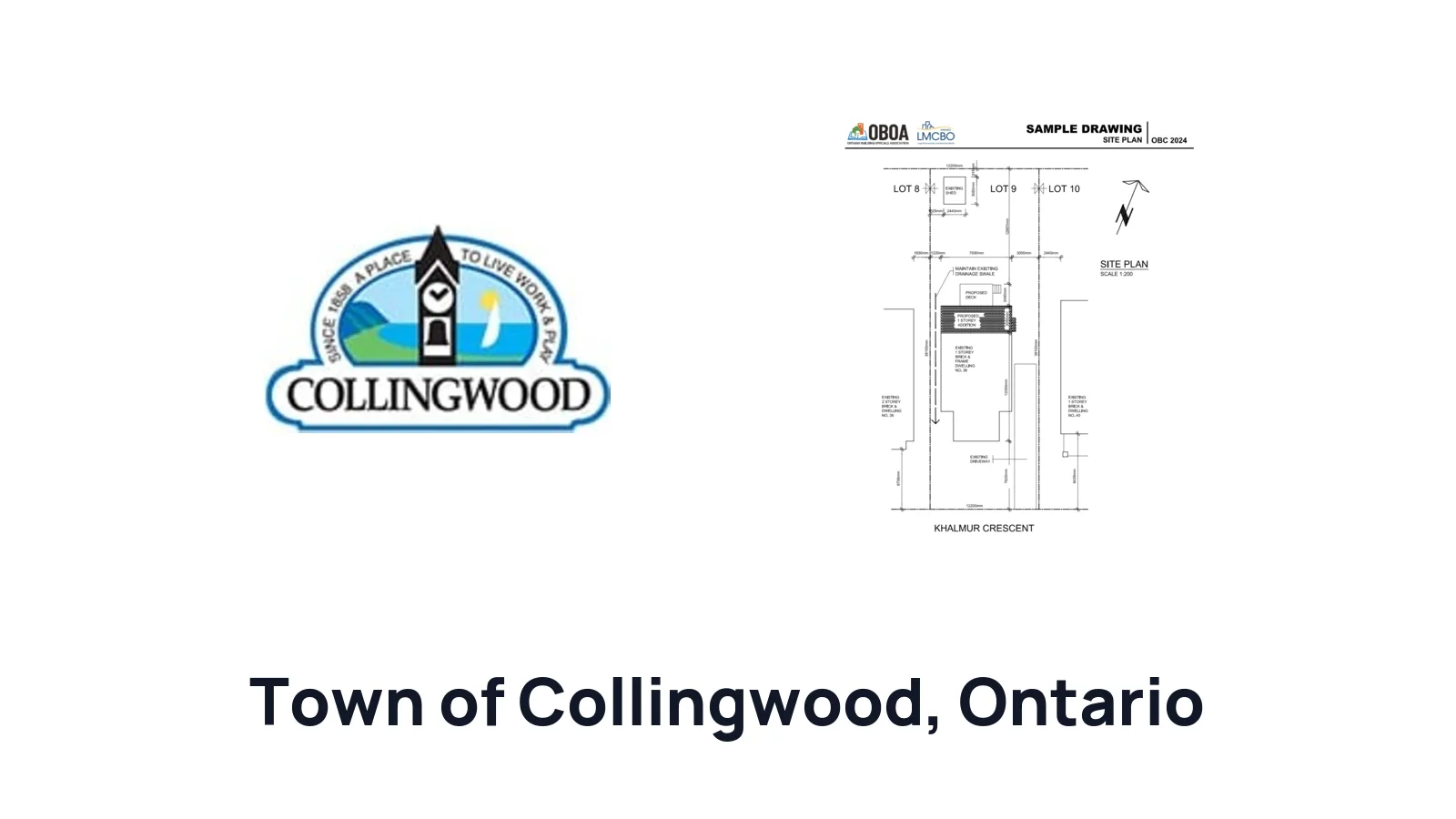
 Site plan example in Town of Collingwood
Use the Town of Collingwood sample as a format guide, but make sure your drawing matches your lot, existing buildings, and proposed structure.
Decks and porches
For a deck or porch, show the proposed deck location, setbacks from property lines, and height above ground. If the deck connects to the house, show the wall or entrance it connects to.
If the house is served by a private septic system, show all distances from the proposed deck.
Swimming pool enclosures
For a swimming pool enclosure, show the proposed pool location, the proposed fence location, and setbacks from property lines. If the house is served by a private septic system, show all distances from the proposed pool.
(Without Survey) How to draw a site plan using the Google Maps method for Town of Collingwood
The Google Maps method can help you make a first draft when you do not have a survey and the permit reviewer has not required one. It works best for simple projects where you need to organize the property layout before creating the final drawing.
Google Maps does not show legal property lines. If your project is close to a lot line, septic system, easement, or other regulated feature, use a survey or confirm the location another way before submitting.
1. Look up your address
Open Google Maps and search for your property address.
 Google Maps search bar
Switch to the satellite view so you can see the house, driveway, yard, fences, and nearby streets. Click Layers, then open the additional map options.
 Click Layers and More in Google Maps
Select Satellite as the map type.
 Select Satellite in Google Maps
Zoom in far enough that the house and the work area are clear, but leave enough space around the property to show the street and lot shape.
2. Take a screenshot
Take a screenshot of the map view.
- On Windows, use
Windows + Shift + S. - On macOS, use
Command + Shift + 4. - On iPhone/iPad/Android, use the device screenshot buttons.
Save the screenshot somewhere easy to find.
 Screenshot of property from Google Maps
3. Open the screenshot in paint
Open the screenshot in a simple drawing tool. Microsoft Paint, Preview on macOS, a tablet markup tool, or any basic image editor can work.
4. Trace the footprint of your house
Trace the outside shape of the house and label it with the property address or the words "existing house."
 House footprint traced on site plan
5. Trace your property boundary
Draw the approximate property boundary around the lot. Label the lines as "approximate property line" unless you are working from a survey.
 Approximate property boundary traced on site plan
6. Trace and label existing structures
Trace existing buildings and structures that matter to the project, such as a garage, shed, deck, driveway, pool, fence, or porch. Label each one as existing.
 Existing structures added to site plan
7. Draw proposed structures
Draw the proposed work on top of the screenshot. Label it clearly, such as "proposed garage," "proposed shed," "proposed deck," "proposed porch," "proposed pool," or "proposed pool fence."
 Proposed structures added to site plan
8. Measure setbacks, proposed, and existing structures
Add the proposed work dimensions and setbacks to property lines. For decks and porches, add the height above ground. For pool enclosures, add the pool and fence locations. If the property has a private septic system, add the septic distances.
Canada-based metric example:
 Canada-based site plan measurements
(Without Survey) How to draw a site plan by hand for Town of Collingwood
You can also draw a simple site plan by hand when a survey is not required. Use a ruler, keep labels readable, and write the setbacks directly on the drawing.
1. Draw the footprint of your house
Start by drawing the outside shape of your house. Label it "existing house" and add the property address.
 House footprint drawn by hand
2. Draw your property boundary
Draw the property boundary around the house. Label each side as a property line. If the boundary is approximate, write "approximate property line."
 Property boundary drawn by hand
3. Draw the main street along your property
Draw the street along the front of the property and write the street name. If the property is on a corner, show both streets.
 Main street drawn on hand site plan
4. Label the rear of your property
Label the rear yard or back of the property so the drawing is easy to orient.
 Rear yard labeled on hand site plan
5. Draw existing and proposed structures
Add existing buildings, then draw and label the proposed work. Include the proposed garage, shed, deck, porch, pool, or pool fence.
 Existing and proposed structures drawn by hand
6. Measure setbacks, proposed, and existing structures
Write the proposed work size and setbacks directly on the drawing. Add deck height above ground and septic distances when those details apply.
 Measurements added to hand-drawn site plan
Create a site plan for free using HomeCat that gets your residential permit approved in Town of Collingwood. Get started
(With Survey) How to draw a site plan using a survey for Town of Collingwood
If you have a property survey, use it as the base for your Town of Collingwood site plan. A survey is useful because it can show legal property lines, existing buildings, easements, rights-of-way, and measurements that are more reliable than a map screenshot.
If you do not have a survey, check your closing documents, ask your real estate lawyer, closing agent, or mortgage company, or submit a Freedom of Information request to the Town of Collingwood. You can also read our guide for getting a property survey in Ontario before paying for a new one.
1. Print your survey, and get an extra blank piece of paper
Print the survey at a readable size. If possible, keep the scale intact. Get a blank sheet of paper, tracing paper, or a transparent digital layer if you are working on a tablet.
Do not mark up your only original copy. Work on a copy so you can start over if needed.
 Example property survey to use as the base drawing
 Blank paper, ruler, and pen for drawing over a survey
2. Place the paper over, and trace important details
Trace the property boundary, house footprint, north arrow, street, setback measurements, easements, existing buildings, and any septic features that affect the project.
 Survey details traced by hand
3. Draw your proposed structures and add measurements and setbacks
Draw the proposed work on the traced survey or survey copy. Label it clearly as proposed and write the dimensions.
Add setbacks from the proposed work to property lines. For a deck or porch, add height above ground. For a pool enclosure, add the pool and fence location. For private septic properties, add the distances from the proposed deck or pool to the septic system.
 Proposed structures drawn on traced survey
Site plan examples for permit for Town of Collingwood
Town of Collingwood provides a sample site plan for garages and sheds. Use it as a format guide for showing existing buildings, the proposed structure, and setbacks.
Site plan example in Town of Collingwood
For decks, porches, and pool enclosures, follow the same basic structure and add the project-specific details: deck height above ground, pool fence location, and septic distances when applicable.
Common site plan mistakes that delay your residential permit in Town of Collingwood
Most site plan delays come from missing location or setback information.
Missing existing buildings
For garages and sheds, show the existing building or buildings on the property. The reviewer needs to understand how the proposed structure relates to what is already there.
Missing setback measurements
Add setbacks from the proposed work to property lines. This is required for garages, sheds, decks, porches, and swimming pool enclosures.
Missing deck height above ground
For decks and porches, include the height above ground. Do not submit only a top-down footprint if the project guidance asks for height information too.
Missing septic distances
If the house is served by a private septic system, show all distances from the proposed deck or proposed pool. Add the septic system location if it affects the project.
Frequently asked questions about site plans
Can homeowners prepare and submit their own drawings in Town of Collingwood?
Yes. In Ontario, a homeowner can generally prepare drawings for a house they own because the Ontario Building Code exempts design work for "a house owned by the person" from the usual designer qualification requirements under Division C, Article 3.2.5.1.(3)(b)(i). Town of Collingwood can still require drawings detailed enough for permit review.
What if Town of Collingwood asks me to fill out Schedule 1: Designer Information?
For the design activities section, select House and describe the project, such as "garage," "shed," "deck," "porch," or "pool enclosure."
Under the designer declaration, choose The design work is exempt from the registration and qualification requirements of the Building Code. For the basis of exemption, write Homeowner.
Where can I get a legal property survey in Town of Collingwood?
Start with your closing documents, then ask your real estate lawyer, closing agent, or mortgage company. If those do not work, submit a Freedom of Information request to the Town of Collingwood.
Read our Ontario ultimate guide for getting a property survey before paying for a new survey.
Does my survey need to be recent?
An older survey prepared by a licensed Ontario Land Surveyor can still be useful if it accurately shows property boundaries and existing conditions. Update your site plan so it shows current buildings, decks, sheds, pools, fences, septic features, and proposed work.
What if Town of Collingwood rejects my site plan?
Read the review comments and revise the drawing to answer each one. Add missing setbacks, existing buildings, proposed work dimensions, deck height, pool fence location, or septic distances as requested.
When do I need a survey or professional drawing?
Use a survey when the project is close to a property line, when septic distances matter, or when the lot shape is unclear. You may need professional help when the project is structural, engineered, complex, or when Town of Collingwood specifically requires it.
Conclusion
A good beginner site plan does not need to be complicated. It needs to show the property, the existing conditions, the proposed work, and the measurements that matter for your residential permit in Town of Collingwood.
Create a site plan for free using HomeCat that gets your residential permit approved in Town of Collingwood. Get started