
How to Draw a Site Plan for a Building Permit in Toronto

Ilya Tkachov
Updated
You are building a deck, and somewhere in the City of Toronto permit paperwork is a line asking for a site plan. Then a list: property lines, lot area, rights-of-way, zoning summary, grade elevations, landscape treatment. It reads like it was written for an architect.
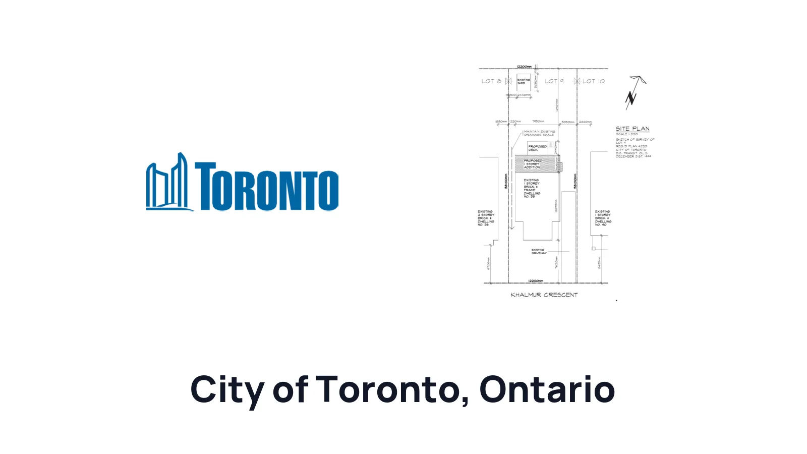
It is more manageable than it looks. A site plan is a measured drawing of your property seen from above, showing what is already there, what you want to build, and how far everything sits from the property lines.
City of Toronto does ask for more detail than most Ontario municipalities — that list is real, and this guide walks through it. It covers the common homeowner projects: decks, porches and verandas, garages and carports, basement entrances, sheds, cabanas and other accessory structures. For each one, the City publishes its own guide, and this page points you at the right one.
Do you need a site plan?
You usually need a site plan when a City of Toronto residential project changes the outside of the property or creates work with a fixed location on the lot. The City publishes a project guide for each of these, and each one lists the site plan information it expects:
- Decks and porches
- Garages and carports
- Residential underpinning, including basement entrances
- Sheds, cabanas and accessory structures
Find your project type above and read that guide alongside this one — it is the checklist your application will actually be measured against.
The site plan is especially important when the project affects setbacks, lot coverage, parking, driveway access, hard or soft landscaping, grade, or the distance between buildings. Even if your project seems small, the drawing needs to let the reviewer verify that the proposed work fits within the zoning and building permit requirements.
Create a site plan for free using HomeCat that gets your residential building permit approved in City of Toronto. Get started
Site plan requirements for residential building permits in City of Toronto
Drawn from the City's small residential project guides, a City of Toronto site plan should generally include:
- Survey or site plan showing property lines
- Lot area
- Rights-of-way and easements referenced to a current survey
- Existing and proposed buildings with overall dimensions
- Setback dimensions to property lines
- Setback dimensions or separation distances to adjacent buildings
- Summary of permitted and proposed zoning provisions
- Lot area, building area, gross floor area, coverage, and grade elevations when required
- Dimensioned parking areas
- Driveways used to access parking spaces
- Hard and soft landscape treatments
- Existing accessory structures such as sheds, decks, detached garages, and other features that affect the review
Use the City of Toronto guide for your project type first. If that guide asks for the same site plan information in a slightly different order, follow the guide and make the drawing easy to compare against it.
Garages, carports, sheds, cabanas, and accessory structures
For a garage, carport, shed, cabana, or other residential accessory building, show all existing and proposed buildings on the lot. Add overall dimensions, setbacks to property lines, and the distance between the proposed structure and other buildings on the property.
Also show dimensioned parking areas and the driveway used to access those spaces. Where required, include the zoning summary with lot area, building area or gross floor area, lot coverage, and grade elevations to confirm height.
Decks, porches, and verandas
For a deck, porch, or veranda, show the proposed work on the survey-based site plan with overall dimensions. Add setbacks to property lines and adjacent buildings, and include the existing house, accessory structures, driveways, parking, hard landscaping, soft landscaping, rights-of-way, and easements when they apply.
City of Toronto's deck and porch guidance also points to permitted and proposed zoning provisions, coverage, and grade elevations. Put those items on the plan or in a clear zoning summary beside the plan so the reviewer does not have to infer them.
Residential basement entrances
For a residential basement entrance, use the same survey-based site plan structure. Show the entrance location, property lines, lot area, easements, rights-of-way, existing and proposed buildings, setback dimensions, zoning provisions, grade elevations, parking, driveways, and hard and soft landscape treatment.
Because basement entrances can affect grading, side yards, walkways, and nearby structures, make the location and measurements especially clear.
How to draw your City of Toronto site plan
You can prepare the drawing yourself or have HomeCat turn the current survey, measurements, and project scope into a Toronto permit site plan. In either case, use the City guide for your project type as the checklist for the finished sheet.
If you would rather draw it yourself, our DIY guide to drawing a site plan in Ontario covers all three methods step by step, with photographs of each stage.
For City of Toronto, go straight to the survey-based method rather than the Google Maps or hand-drawn options. The City asks for rights-of-way and easements referenced to a current survey, so an approximate boundary traced from an aerial photo will not satisfy the checklist.
If you do not have a survey, check your closing documents, ask your lawyer, closing agent, or mortgage company, or request building records from the City — City of Toronto holds drawings on file for many properties. Read our guide to getting a property survey in Ontario before paying for a new one.
Once you have the drawing, add the items City of Toronto asks for that a generic site plan will not include: a permitted and proposed zoning summary, lot area, building area or gross floor area, lot coverage, grade elevations, parking dimensions, driveway access, and hard and soft landscape treatment. Put them beside the drawing or in a small table rather than burying them in loose notes.
As an example of the arithmetic reviewers expect: if the survey shows the rear wall of the house 9 metres from the rear lot line and you are adding a 3 metre deck, the remaining rear setback is about 6 metres. Write both the deck depth and the remaining setback directly on the plan.
Create a site plan for free using HomeCat that gets your residential building permit approved in City of Toronto. Get started
Common site plan mistakes that delay your residential building permit in City of Toronto
Most City of Toronto site plan delays come from missing survey information, missing zoning details, or a drawing that does not connect the proposed work to the rest of the lot.
Not referencing a current survey
City of Toronto's small residential guides refer to rights-of-way and easements being referenced to a current survey. Use survey-based property information for the permit drawing, especially when the project is near a lot line, driveway, parking space, easement, right-of-way, or another building.
Missing zoning summary
Add the permitted and proposed zoning provisions that apply to the project. Where required, include lot area, building area, gross floor area, lot coverage, and grade elevations.
Missing parking and driveway details
For garages, carports, and accessory structures, show dimensioned parking areas and the driveway used to access the parking spaces. If the proposed work changes the driveway, parking layout, or hard landscaping, make that change obvious on the plan.
Missing distances to adjacent buildings
Do not stop at property-line setbacks. City of Toronto's guides also ask for setback dimensions to adjacent buildings. Show the distance between the proposed work and other buildings on the lot when that relationship affects the review.
Treating landscaping and grade as afterthoughts
Hard and soft landscape treatment, coverage, and grade elevations can matter for zoning and height review. Add them when the project guide asks for them instead of waiting for a revision request.
Frequently asked questions about site plans
Can homeowners prepare and submit their own drawings in City of Toronto?
Yes. In Ontario, homeowners can generally prepare drawings for a house they own because the Ontario Building Code exempts design work for "a house owned by the person" from the usual designer qualification requirements under Division C, Article 3.2.5.1.(3)(b)(i). City of Toronto can still require survey-based property information, complete dimensions, zoning summaries, grade elevations, and other permit details.
What if City of Toronto asks me to fill out Schedule 1: Designer Information?
For "Design activities undertaken by individual identified in Section B," select House. In the description, enter the project type, such as "deck," "porch," "garage," "carport," "basement entrance," or "accessory structure."
Under "Declaration of Designer," choose The design work is exempt from the registration and qualification requirements of the Building Code. For "Basis for exemption from registration and qualification," write Homeowner.
Where can I get a legal property survey in City of Toronto?
Start with your closing documents, then ask your real estate lawyer, closing agent, or mortgage company. If those options do not work, submit a building records disclosure request to City of Toronto. City of Toronto keeps survey records indefinitely; they are not destroyed on a routine schedule.
Read our Ontario ultimate guide for getting a property survey before ordering a new survey.
Does my survey need to be recent?
City of Toronto's guides use the wording "current survey," especially for rights-of-way and easements. An older Ontario Land Surveyor survey can still be a useful starting point if it accurately reflects the property, but the permit drawing should show current conditions, including existing structures, driveways, parking, hard and soft landscaping, grade information, and the proposed work.
If the survey does not reflect the lot today, update the site plan information or ask City of Toronto what it will accept before submitting.
Can I use Google Maps for my City of Toronto site plan?
Use Google Maps only for private planning. It can help you think through the project location, but it does not replace a survey-based permit drawing for the City of Toronto residential project guides covered here.
What if City of Toronto rejects my site plan?
Read the review comments and revise the drawing to answer each item. Common fixes include adding the current survey reference, property lines, lot area, easements, rights-of-way, existing and proposed building dimensions, setbacks, zoning summary, parking dimensions, driveway access, landscape treatment, or grade elevations.
When do I need a professional drawing?
You may need professional help when the project is structural, engineered, complex, close to a regulated condition, or when City of Toronto specifically asks for a qualified professional. For the property-location part of the package, start with the survey and the project guide, then make the site plan clear enough for the reviewer to verify the proposed work.
When the application also requires floor plans, elevations, sections, or construction details, keep those sheets coordinated with the site information in one building permit drawing package.
Conclusion
A good beginner site plan does not need to be complicated. It needs to show the property, the existing conditions, the proposed work, and the measurements that matter for your residential building permit in City of Toronto.
Create a site plan for free using HomeCat that gets your residential building permit approved in City of Toronto. Get started