
What Is a Site Plan for a Building Permit in Ontario?

Ilya Tkachov
Updated
A site plan for a building permit is a scaled, top-down drawing showing your property lines, existing structures, the proposed construction, and the required setbacks between them. Ontario municipalities use it to check your project against the local zoning by-law before they issue the permit.
It is not an architectural drawing, it does not need to be beautiful, and for most residential projects you can draw it yourself.
This guide covers what the drawing must show, when a permit needs one, how it differs from a survey and from site plan control, and how to get one.
What is a site plan for a building permit?
Picture your property from directly above, as though you were looking down from a drone. Draw the outline of the lot, the house, the driveway, the shed. Now add the thing you want to build, and write down how far it sits from each property line.
That is a site plan.
The purpose is narrow and practical: it lets a plans reviewer confirm that what you want to build fits on the lot and respects the rules that apply to it—without visiting the property. Every requirement follows from that. If a detail helps answer “does this fit and is it far enough from the boundary”, it belongs on the drawing. If it does not, leave it off.
Why Ontario municipalities require one
Building permits in Ontario are issued by your municipality, working from the Ontario Building Code plus that municipality's own zoning by-law. The building code deals largely with how a structure is built; the zoning by-law deals with where it can go—and the site plan is how the reviewer checks the “where”.
Setbacks, lot coverage limits, and easements are what your project gets measured against, and none of them can be checked from a photo or a written description. It takes a dimensioned drawing.
Because zoning by-laws are municipal, the specific numbers differ between Toronto, Ottawa, Windsor, and everywhere else. The drawing is much the same everywhere; the thresholds it is checked against are local. That is why the useful question to ask your building department is not “what does a site plan look like” but “what are the setbacks for my project on my lot”.
The site plan terms you need to know
The rest of this guide—and every conversation you have with your building department—uses these terms. They are worth two minutes now.
| Term | What it means | Example |
|---|---|---|
| Setback | The distance from a structure to a property line. | 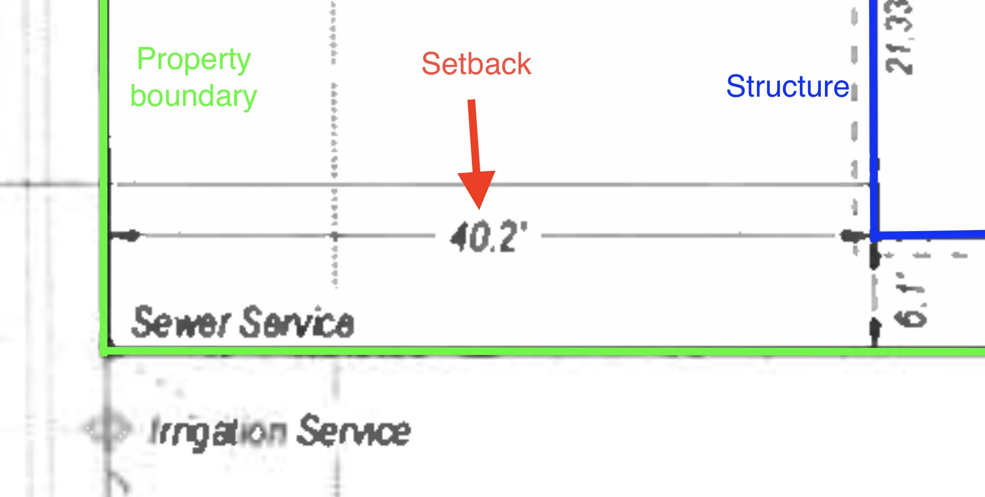 |
| Property line | The legal edge of your lot. Usually taken from a survey—fences are often not on it. | 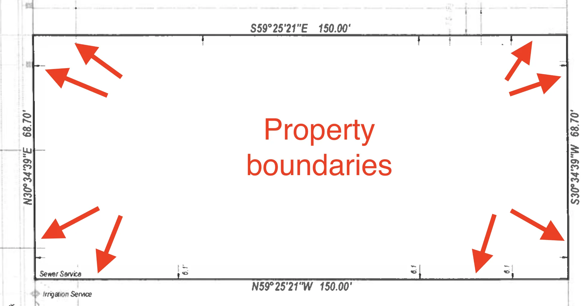 |
| Existing structures | What is already on the lot: house, garage, deck, shed, driveway, porch, pool, fence. | 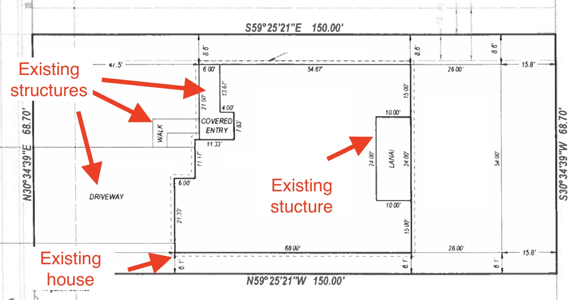 |
| Proposed structures | The new work you want approved. | 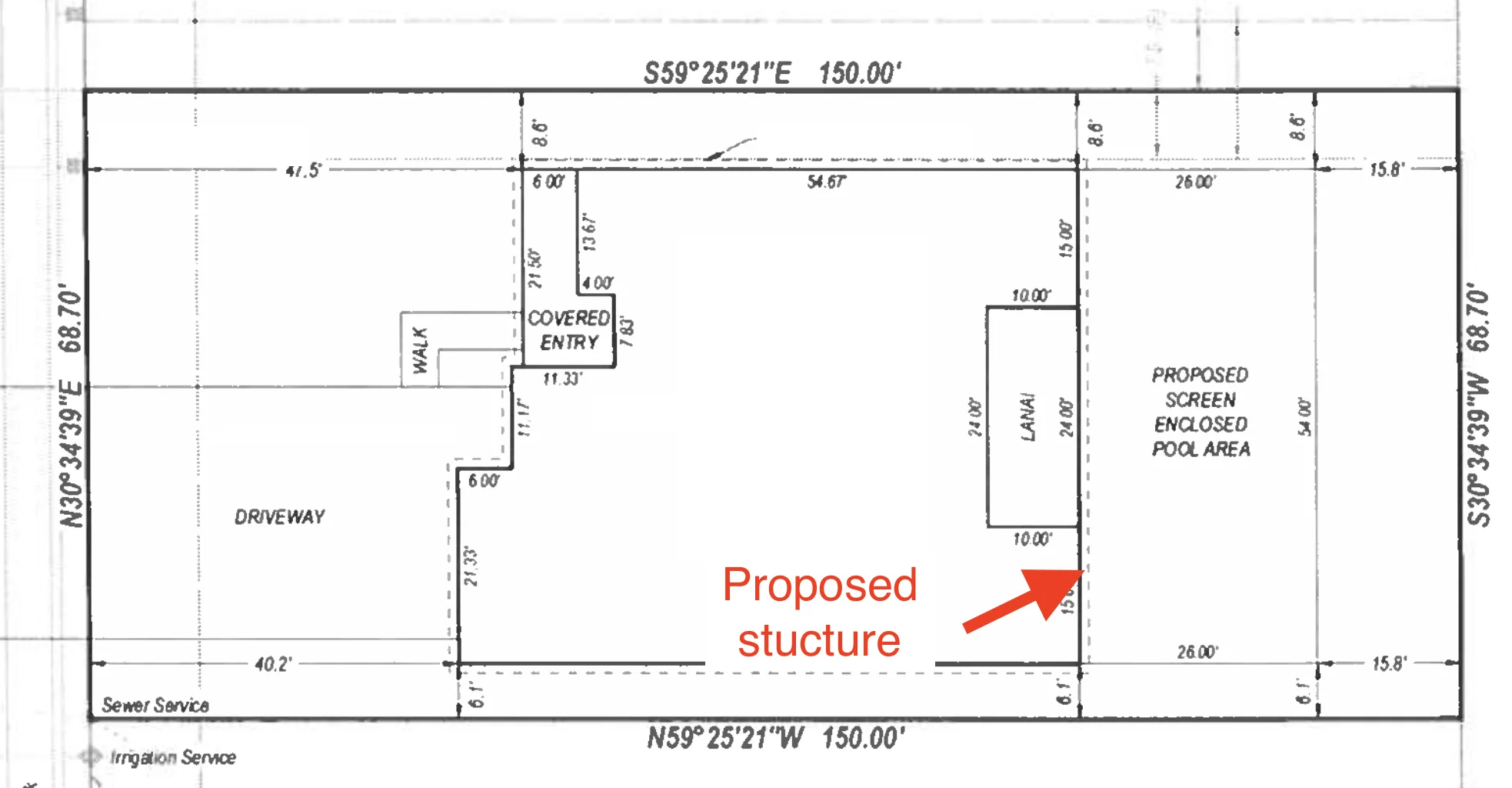 |
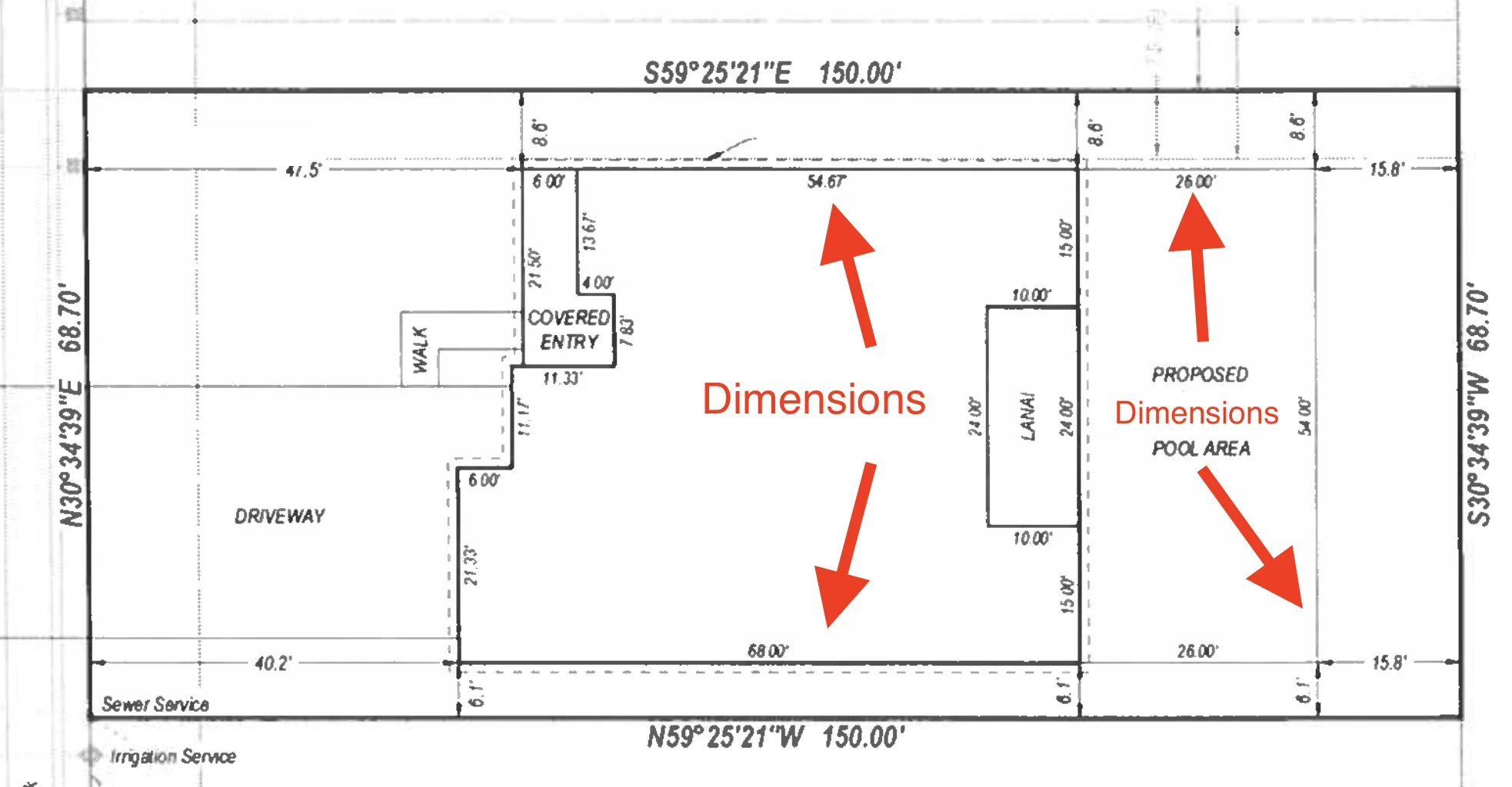
| Dimensions | Measurements written directly on the drawing. | |
| Lot coverage | How much of the lot your buildings cover, usually as a percentage the by-law caps. | |
| Easement | A registered right for someone else to use part of your land—often utilities. You usually cannot build on it. | 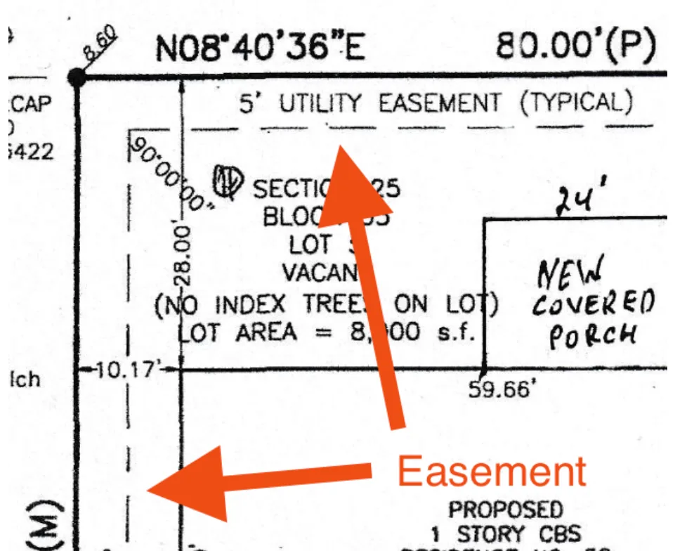 |
| Right-of-way | A registered right of access across part of your property, such as a shared driveway. | 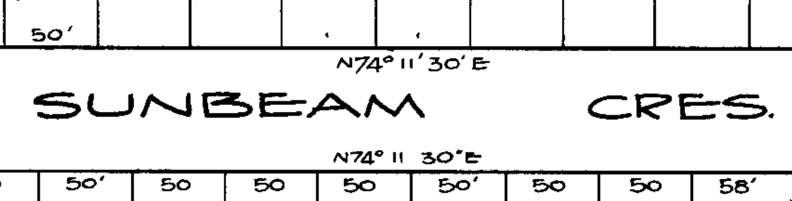 |
| Lot grading | The slope and elevations of the land, used to check drainage and height. | 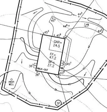 |
Create a site plan for free using HomeCat and skip the drawing entirely. Get started
What must a building permit site plan show?
Municipal checklists word this differently, but they are all asking for the same drawing. At minimum it needs:
- The property boundary, with lot dimensions
- The existing house and every other existing structure on the lot
- The proposed work, clearly labelled as proposed
- The size of the proposed structure
- The distance from the proposed work to every property line—not only the closest one
- The distance from the existing house to the property lines
- A north arrow
- The property address
- Units on every measurement, so feet and metres are never ambiguous
Add anything on the lot that constrains where you can build: easements and rights-of-way, the septic tank and bed, overhead electrical lines, and mature trees where your municipality asks for them. Some municipalities also want lot coverage calculated, grade elevations at the corners of the building, or a zoning summary comparing required setbacks to proposed ones.
The two habits that matter most are labelling everything as existing or proposed—solid lines for existing, dashed for proposed, with a short legend—and writing every distance down. Missing setbacks are the single most common reason a plan is sent back. Our DIY guide has the full list of reasons plans get returned.
Example of a residential building permit site plan
Here is a finished residential site plan of the kind an Ontario building department expects—in this case for a proposed rear deck.
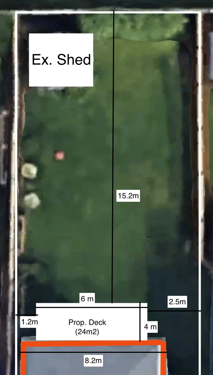
Read it the way a plans reviewer does:
- The lot boundary frames the drawing, with the street along the front and a north arrow for orientation.
- The existing house is drawn in place, with its distance to the property lines shown.
- The proposed deck is distinguished from what already exists and labelled as proposed.
- Every setback is written on the drawing as a number with units, on all sides—not scaled off the page.
Nothing on it is decorative. A reviewer can confirm the deck fits and complies without leaving their desk, which is the entire job of the drawing.
When do you need a site plan for a building permit?
You generally need one when a project changes the outside of the property or puts a structure in a fixed position on the lot. In Ontario that commonly includes:
- Decks, porches, and verandas
- Sheds, cabanas, and accessory buildings
- Detached garages and carports
- Additions
- Basement walkouts and separate entrances
- Driveway widening
- Pools and fence enclosures
Interior-only work—finishing a basement, for example—often does not need a site plan, because nothing about the lot changes.
When you might not need one at all
Some small structures do not require a building permit in the first place, which means no site plan either. Whether yours qualifies depends on floor area, height, and whether it is attached to the house, and the thresholds vary by municipality. Ask your building department before assuming either way—it is a short call, and it is the cheapest step in the whole process.
Be aware that “no building permit” does not always mean “no rules”. Zoning setbacks can still apply to a structure that needs no permit, and pool enclosure requirements apply regardless.
Site plan for a building permit vs site plan control
These two share a name and are constantly confused, but they are separate processes handled by different departments.
| Building permit site plan | Site plan control | |
|---|---|---|
| What it is | A drawing you submit with a permit application | A municipal planning approval under section 41 of the Planning Act |
| Who reviews it | The building department | The planning department |
| What it covers | Where the structure sits on the lot, and its setbacks | Site layout, access, parking, servicing, stormwater, landscaping |
| Who it applies to | Anyone applying for a building permit | Development in an area the municipality has designated by by-law |
For a homeowner, the practical answer is that a deck, shed, detached garage, or addition on a single residential lot almost never triggers site plan control. You need the drawing, not the planning approval.
Ontario also narrowed site plan control for smaller residential projects: the More Homes Built Faster Act, 2022 exempted residential development of ten units or fewer, and O. Reg. 254/23 sets out the areas where that exemption does not apply. If your building department tells you the property is within a site plan control area, that is a separate application—ask the planning department, not the building counter.
Site plan vs survey, floor plan, and elevation
This trips up most first-time applicants, and using the wrong word with your building department causes real delays.
| Drawing | What it shows | Example |
|---|---|---|
| Site plan | Your whole lot from above—boundaries, existing structures, the proposed work, and the setbacks between them. You or a designer draws it. Example: your back yard showing a proposed deck 3.5 m from the rear lot line. | 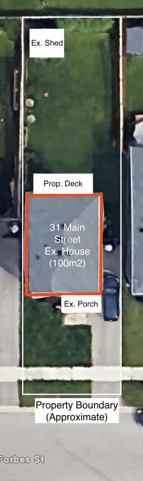 |
| Survey | The legal property boundaries, measured on the ground and certified. Only an Ontario Land Surveyor can produce one. Example: the plan in your closing documents showing lot dimensions and the house position. | 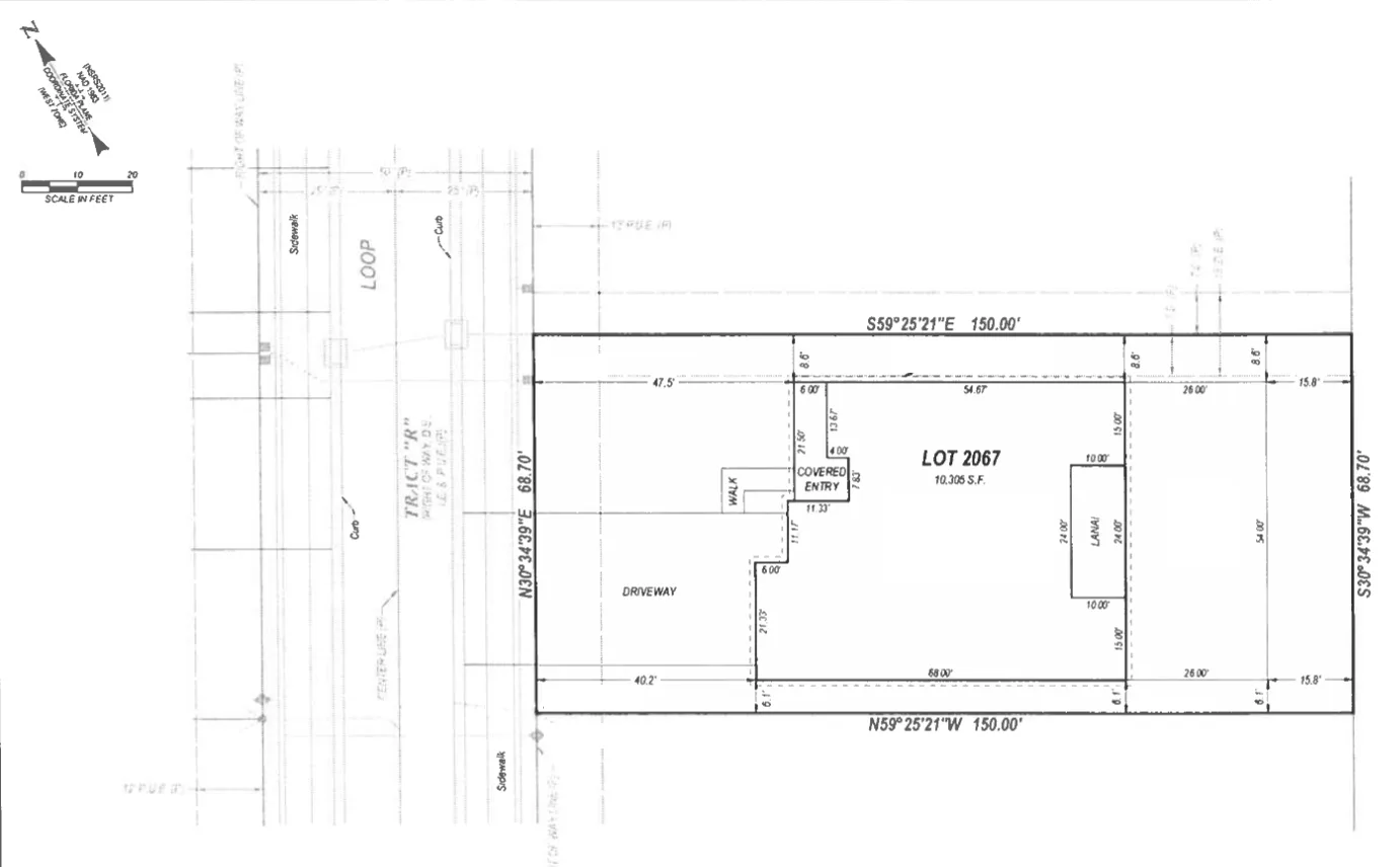 |
| Floor plan | One structure seen from above, showing how it is built—rooms and walls for a house, joists, beams and footings for a deck. It never shows the whole lot. Example: the framing plan for a proposed deck off the back of the house. | 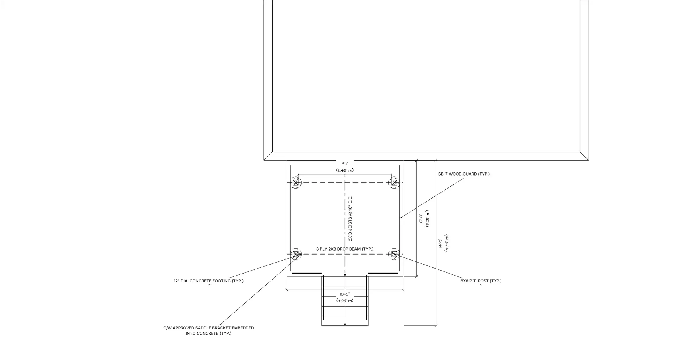 |
| Elevation | One structure seen straight on from the side, showing height rather than position on the lot. Example: the rear of a house with floor levels and grade marked. | 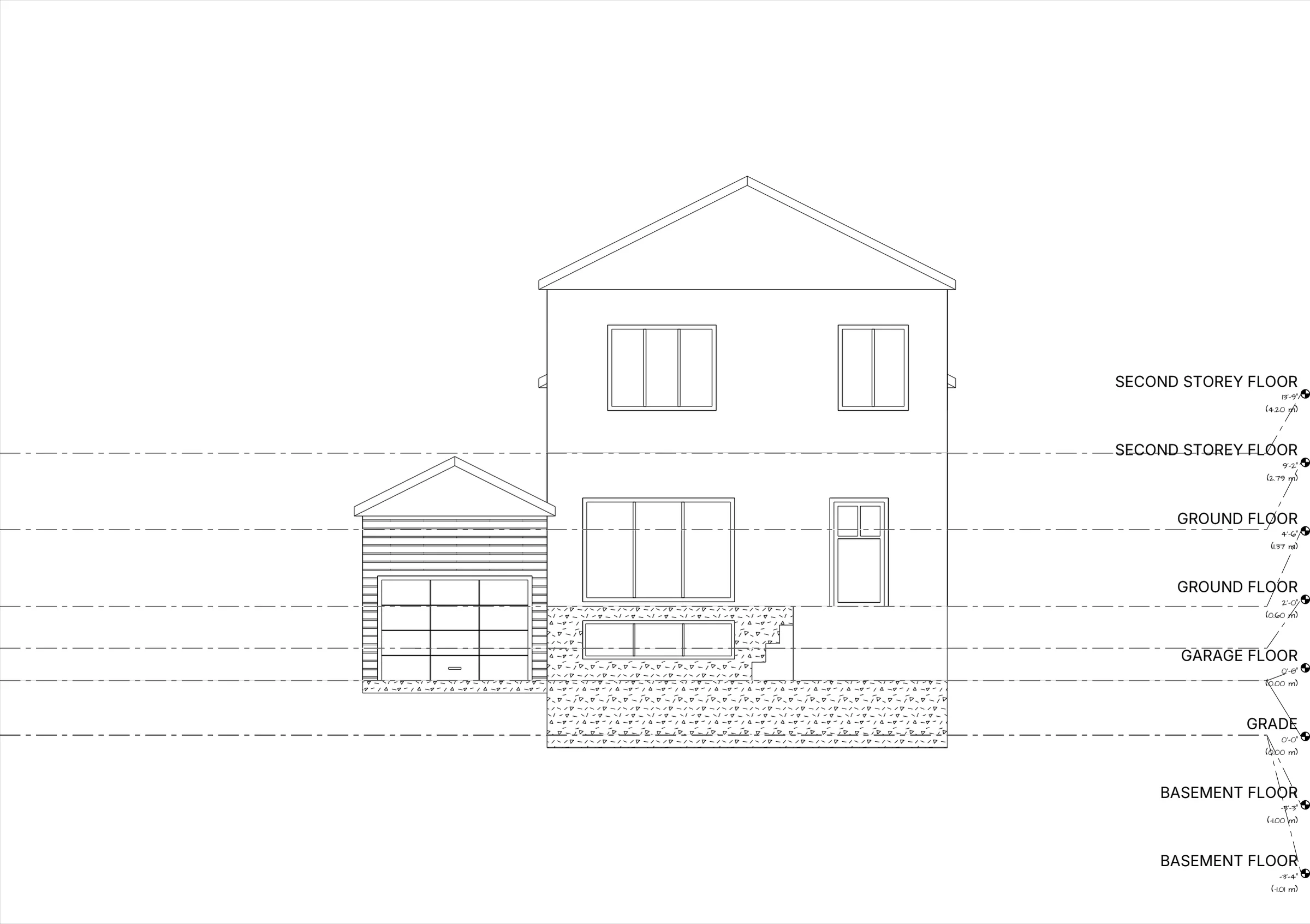 |
The important distinction is site plan vs survey. A survey is a legal document produced by a licensed surveyor establishing where your boundaries actually are. A site plan is a drawing you prepare showing your project on the lot—and it is often drawn on top of a survey.
This matters because being told “we need a site plan” does not automatically mean “pay for a survey”. Those are different things, and conflating them is what leads people to spend money they did not need to. Our guide to getting a property survey in Ontario covers when you genuinely need one and the cheaper ways to get it.
Can you draw your own building permit site plan?
Yes. Ontario municipalities do not require a site plan to be prepared by an architect, engineer, or surveyor for ordinary residential permits—they require it to be accurate, complete, and legible. Most homeowners can produce an acceptable one with a tape measure and an afternoon.
The exception is the boundary. If your project sits close to a property line, or the boundary is genuinely uncertain, a reviewer may ask for a survey as the base drawing. Ask your building department directly: “will you accept a dimensioned site plan I draw myself, or do you require a survey as the base?”
| Option | Cost | Time | Best for |
|---|---|---|---|
| HomeCat | Free | Minutes | Most residential projects |
| Draw it yourself | Free | An afternoon, plus measuring | Simple projects, if you are comfortable with a tape measure |
| Hire a designer or surveyor | Paid, varies | Days to weeks | Complex projects, additions, or a genuinely disputed boundary |
Using HomeCat
Walk your property with your phone and you get a permit-ready site plan back, free. Nothing to measure, nothing to trace, and nothing to redraw when you realise a setback is missing.
Create a site plan with HomeCat
Drawing it yourself
Realistic for most homeowners on most residential projects, and free apart from your time. You will need a tape measure, an afternoon, and a willingness to check your own work—missing measurements, not untidy drawing, are what get plans sent back.
Our DIY guide to drawing a site plan in Ontario walks through three methods: from a survey, from a Google Maps screenshot, or by hand on paper.
Using a designer or surveyor
Worth the cost for complex projects, additions, or where the property boundary is genuinely in dispute. A designer prepares the drawing; a surveyor establishes where your boundaries actually are. They are different jobs, and you may only need one of them.
If what you are missing is the boundary rather than the drawing, read our guide to getting a property survey in Ontario first—there are usually cheaper routes than commissioning a new survey.
Site plan requirements by Ontario municipality
The drawing is the same across the province; the checklist and the setback numbers are local. We have a guide for each municipality covering what its building department asks for and where to find its zoning requirements:
See all Ontario site plan guides for the rest, including Oakville, Oshawa, Guelph, Barrie, Whitby, Ajax, Milton, Waterloo, Cambridge, Kingston, St. Catharines, Richmond Hill, Newmarket, Aurora, Sarnia, and Collingwood.
Conclusion
A site plan for a building permit is a top-down drawing of your lot showing what exists, what you propose, and how far it all sits from the property lines. Ontario municipalities use it to check your project against the local zoning by-law before issuing a permit. It does not need to be professionally drafted—it needs to be accurate, clearly labelled, and complete, with every setback written down.
If you are ready to draw one, start with the DIY guide.
Walk your property with your phone and get a permit-ready site plan from HomeCat, for free. Get started